
Why the monsoon is delayed this year

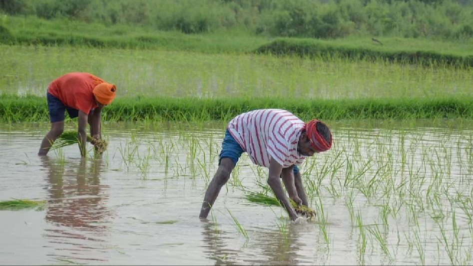
The Indian Meteorological Department predicts below-average rainfall for August and September.
What greater disaster can there be if the clouds do not rain in Ashadha and Sawan? The monsoon seems to have stalled. In June, the heatwave troubled people, and in July, there was only nominal rainfall. India witnessed two completely opposite weather patterns in July. While some areas faced floods, others experienced drought. Excessive rainfall in Gujarat, Assam, Maharashtra, and Odisha led to floods and landslides, whereas most parts of the country remained hot and dry, leading to heatwave conditions. Such a situation in a monsoon month like July is considered rare. The India Meteorological Department has also expressed concerns about below-average rainfall in August and September.
Indian Express reports that the India Meteorological Department (IMD) stated on Friday that there is a "most likely" chance of below-average rainfall across the country in the second half of the monsoon season. This means that the rainfall could be less than 94% of the Long Period Average (LPA).
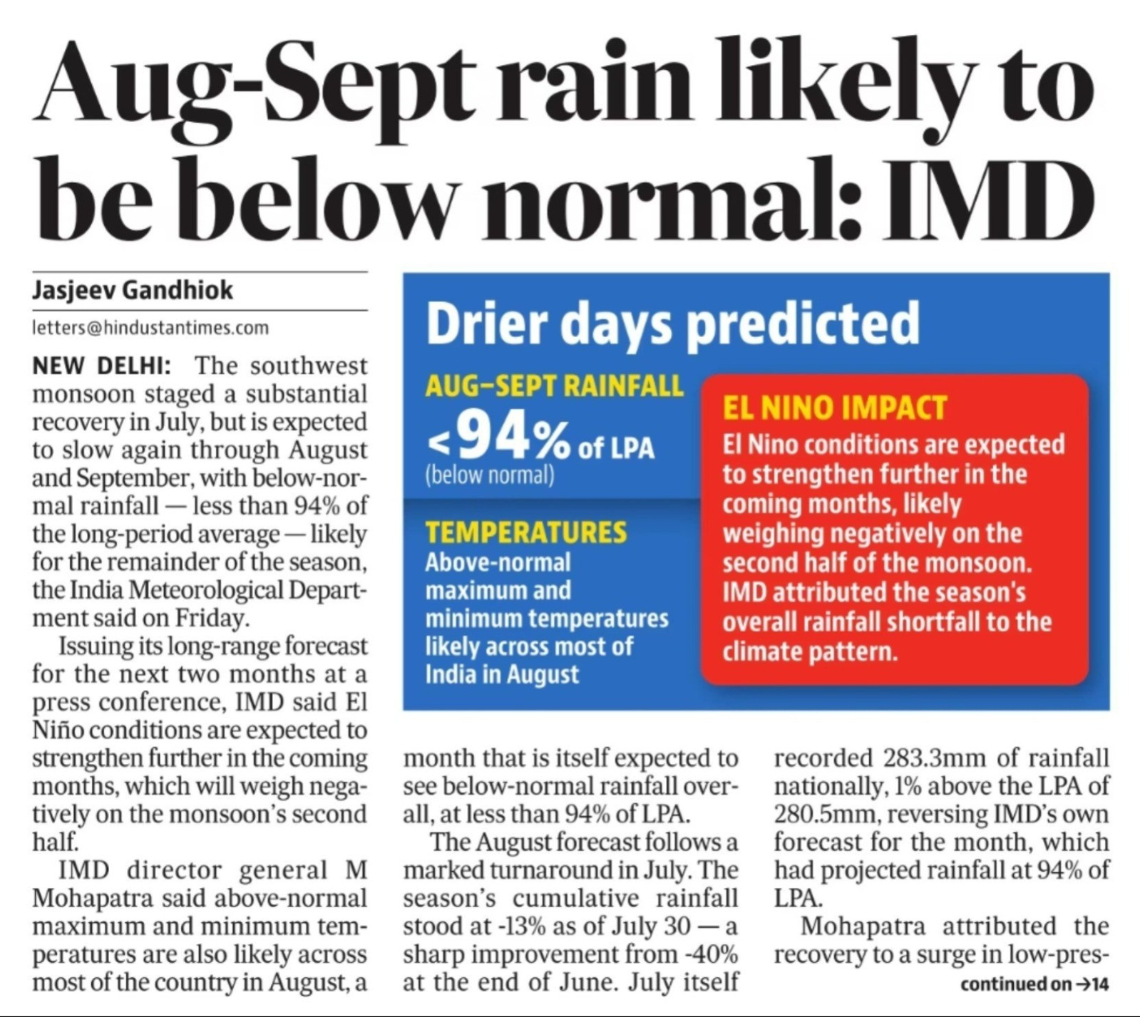
The southwest monsoon, which lasts from June to September, accounts for about three-quarters of India's annual rainfall. Therefore, it is crucial for agriculture, water reservoir storage, hydroelectric power generation, and the broader economy of the country. After below-average rainfall in the first half of the monsoon, there is now a concern of below-normal rainfall in August and September as well. While large areas of the country remained dry in the first half of the monsoon, some regions experienced flood-like situations due to excessive rainfall.
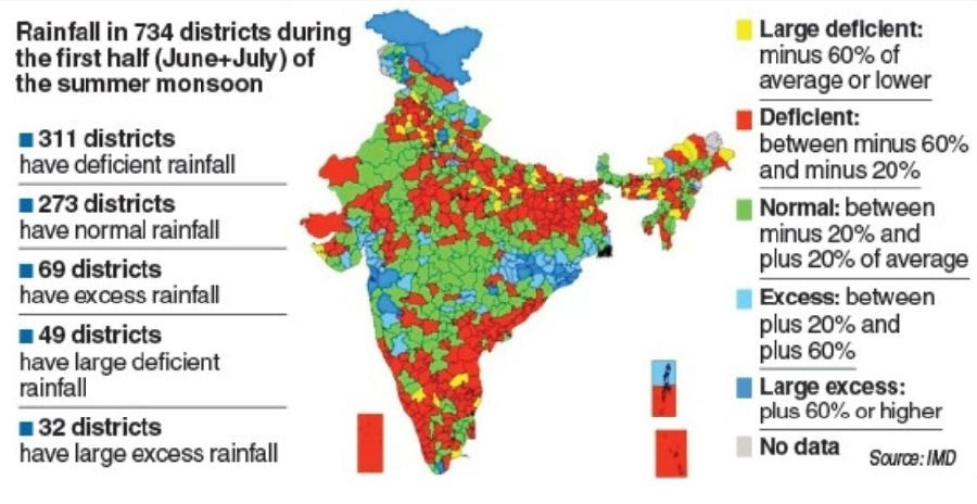
It is noteworthy that the uneven pattern of rainfall is already visible in the country. Between June 1 and July 30, the total rainfall in the country was about 13% below the long-term average. Rainfall deficiency was recorded in 16 states, covering slightly more than one-third of the country's total area. In the 'deficient rainfall' category, rainfall is 19% to 59% below normal. Out of the 734 districts assessed for rainfall data, 360 districts experienced deficient or scanty rainfall. 'Scanty rainfall' means a deficiency of 60% or more from normal. Conversely, 101 districts recorded above-normal or excess rainfall. This season, major crops like paddy, soybean, maize, pulses, groundnut, and cotton are grown. Therefore, the monsoon situation can directly impact agricultural production.
Now, the forecast of weak rainfall for the second half of the monsoon, i.e., August and September, comes at a time when the El Niño effect on the monsoon persists. El Niño is a condition of increased sea surface temperatures in the equatorial Pacific Ocean, which can weaken monsoon winds over the Indian subcontinent. However, agricultural meteorologists say it is too early to predict the exact impact of below-normal rainfall on crops. Crop yields depend significantly on local conditions and the timing and amount of rainfall.
According to Roxy Mathew Koll, a meteorologist at the Indian Institute of Tropical Meteorology (IITM) in Pune,
"The patterns we are observing show the combined effect of climate change and El Niño." Due to the impact of El Niño, monsoon winds have generally been weaker than normal. On the other hand, the Arabian Sea and the Indian Ocean are unusually warm, providing a large amount of moisture in the atmosphere. When monsoon winds strengthen for a short period, this moisture moves rapidly and causes intense rainfall in a short time.
However, IMD Director General Mrutyunjay Mohapatra said that the good rainfall in July significantly reduced the 35% rainfall deficiency recorded in June. During July, four low-pressure areas formed in the Bay of Bengal. Two of these later developed into deep depressions. These systems caused widespread rainfall over large parts of central India. Such weather systems play a crucial role in transporting moisture from the sea to the Indian landmass and causing rainfall.
According to Mohapatra, despite the moderate El Niño conditions in the equatorial Pacific Ocean, these systems in the Bay of Bengal helped maintain rainfall in east-central and west-central India. IMD has also predicted that maximum temperatures will remain above normal in most parts of the country during August. Some agricultural meteorologists are concerned that below-normal rainfall in the second half of the monsoon could lead to 'terminal drought' conditions in some areas by September, affecting crops like groundnut, cotton, and paddy.
After an extremely dry June and a weak start to the monsoon, July experienced extreme weather conditions. There were several days of heavy rainfall in July, and some places even set historical records. However, there were also long dry spells during this period. The beginning of July saw a nationwide rainfall deficiency of about 35%. This situation has reignited an old debate about whether the 'breaks' in the Indian monsoon, i.e., periods of no rainfall, are becoming longer and more frequent.
According to Dr. Rajeev Chattopadhyay, a scientist at IITM,
The 'active-break monsoon cycle' refers to the alternation between 'active' periods of more rainfall and 'break' periods of less rainfall during the monsoon. These fluctuations can occur over a period of about 10 to 90 days and are a normal feature of the Indian monsoon.
During the 'break phase' of the monsoon, rainfall decreases rapidly in central and northwestern India. This happens because the monsoon trough shifts northward, reaching closer to the foothills of the Himalayas. During this time, the rain-bearing weather systems coming from the Bay of Bengal also decrease. Conversely, rainfall increases in the Himalayan foothills, northeastern India, and sometimes towards the equatorial Indian Ocean.
According to Dr. Chattopadhyay,
The 'break' is a part of the natural fluctuations in rainfall during the monsoon. Conversely, when there is continuous heavy rainfall over a large area, it is called an 'active spell.'
According to Dr. Akshay Deoras, a senior research scientist at the National Centre for Atmospheric Science and the University of Reading,
Such fluctuations within the monsoon are normal, especially in El Niño years. El Niño generally weakens the monsoon, but short-term atmospheric changes can cause very heavy rainfall in between. The same reason appears to be behind the weak June and the current monsoon break this year.
According to Dr. Deoras, the slow progress of the monsoon in June was related to extremely dry air coming from the arid regions of western and northwestern India. These dry winds stabilize the atmosphere, reducing the formation of rain-bearing clouds and decreasing rainfall. Similar dry winds are currently affecting India and contributing to weakening the monsoon.
Their research suggests that most monsoon break phases are related to such dry winds. When the impact of these winds is very high, the monsoon break can be more severe. The significant fluctuations in rainfall this year have raised this question again, but scientists say there is no clear evidence of an increase in monsoon breaks in the long term. According to Dr. Chattopadhyay, prolonged dry spells can delay crop sowing, increase irrigation costs, and affect fertilizer use.