
China claims 28 areas in Ladakh, India had named them officially

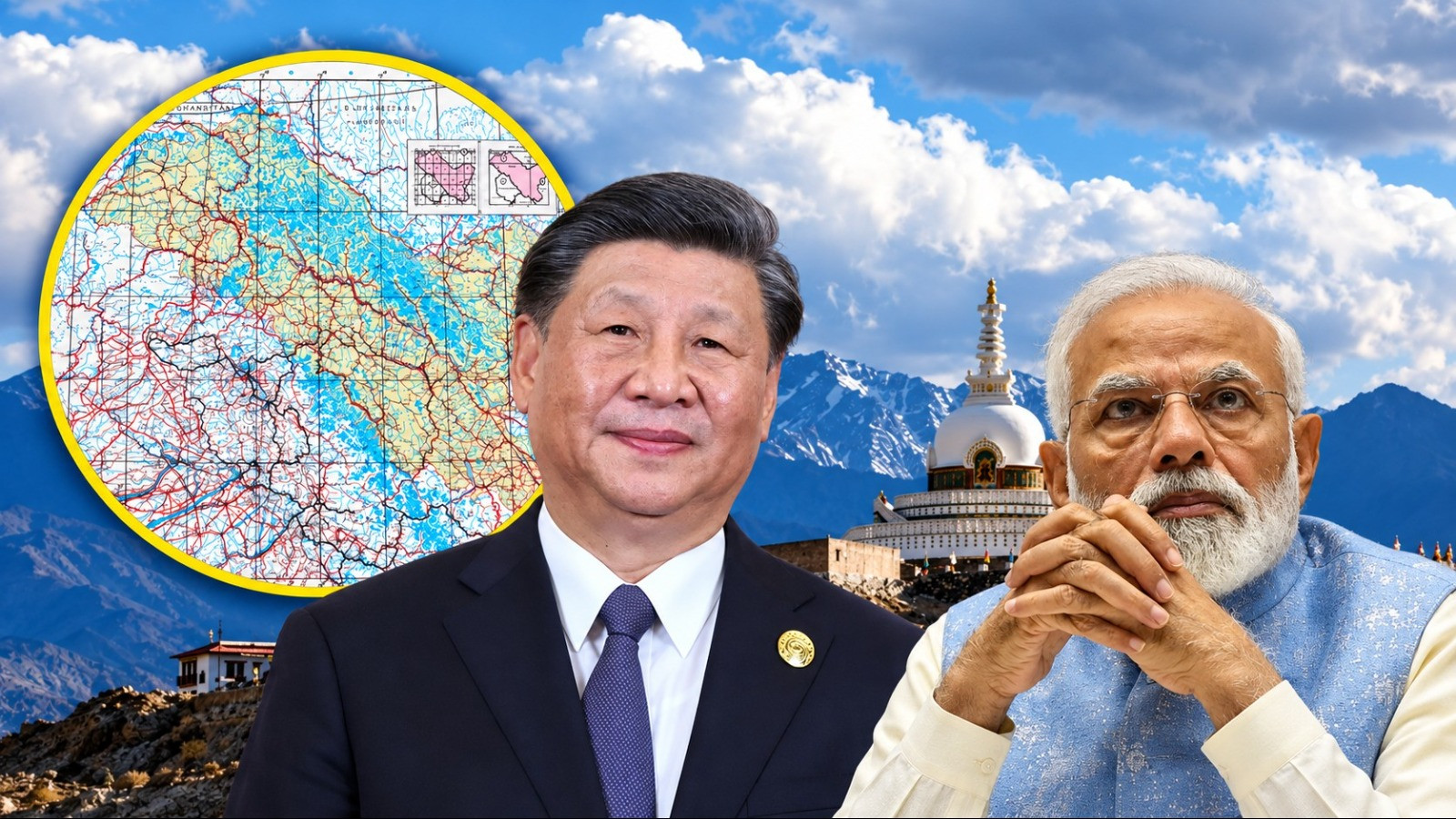
These include regions like Gogra and Hot Springs, where tensions arose between Indian and Chinese troops in 2020.
China raised objections on Tuesday regarding the standardized names of 28 strategic locations and geographical areas in Ladakh decided by India. China has claimed these 28 places in Ladakh as its own. On Tuesday, China also objected to India's decision to name these locations. China stated, "These areas belong to us, and changing India's names or giving new names will not change ownership on the ground." India officially decided on the names of these places on October 2. This includes areas like Gogra and Hot Spring, where tensions arose between Indian and Chinese soldiers in 2020.
Beijing claimed that the relevant areas belong to it and that India's move will not change the status of the border. China's response comes at a time when India has decided on these locations to bring uniformity in the official identification and mapping of sensitive border areas.

Global Times reported that Chinese Foreign Ministry spokesperson Mao Ning said during a media briefing in Beijing that,
China opposes the names announced by India. She also reiterated her country's longstanding objection to Ladakh being made a Union Territory. Mao stated, "China has never recognized the so-called 'Union Territory of Ladakh' unilaterally and illegally established by India."
In response to questions regarding the announcement of standardized names for 28 locations and geographical areas in Ladakh by India's Ministry of Home Affairs, Mao Ning described this step as "illegal and invalid." She claimed that India's announcement does not change the fact that the relevant areas in the western sector of the India-China border have always belonged to China. This is China's claim, which it reiterated during its response to the naming.
On October 2, India formally identified and decided on standardized names for 28 strategic locations and geographical areas in Ladakh. This includes significant locations like Gogra and Hot Spring, which are situated near the Line of Actual Control (LAC). Both areas were major points of confrontation during the military standoff between Indian and Chinese soldiers in 2020.
The central government has officially decided on the names of 28 locations and natural geographical features in Ladakh and recorded them on maps. The Ministry of Home Affairs provided this information on October 2. This includes mountain peaks, hills, passes, glaciers, valleys, rivers, lakes, and other terrains. The ministry has also released a map marking these locations.
The central government has taken this initiative in consultation with the Ladakh administration. The aim is to organize the names and identifications of locations in official maps, ensure accurate mention of the relevant areas, and enhance public awareness about sensitive border areas. The use of standardized names will allow for uniform references to these locations in government documents and maps.
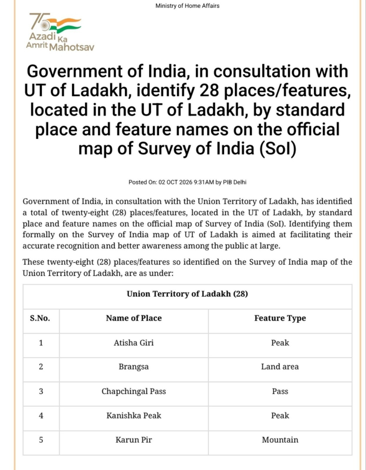
This list includes not only mountain peaks but also passes, valleys, rivers, glaciers, and other strategic locations. Thus, the standardization of names is linked to the identification of various geographical structures in Ladakh. The declared objective of the government initiative is to ensure clear identification of these areas, while China has registered its opposition by linking it to its territorial claims.
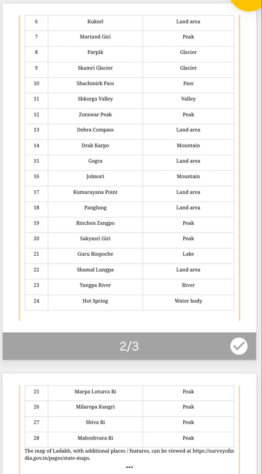
The inclusion of Gogra and Hot Spring in the list makes this decision particularly significant. These two areas became major centers of tension between India and China during the standoff in 2020. Their importance remains for Indian patrols near the LAC. Therefore, the clear and uniform use of their names is crucial in the context of identifying the border geography.
The military standoff in Eastern Ladakh began on May 5, 2020, following a violent clash between Indian and Chinese soldiers in the Pangong Lake area. Subsequently, tensions escalated along the border between the two countries. In 2022, both sides initiated the process of disengagement of troops. Against this backdrop, the mention of areas like Gogra and Hot Spring has remained significant in border-related developments.
The list issued for Ladakh includes all 28 locations and their geographical categories as follows:
| Serial Number | Location Name | Geographical Category |
| 1 | Atisha Giri | Mountain Peak |
| 2 | Brangsa | Geographical Area |
| 3 | Chapchingal Pass | Pass |
| 4 | Kanishk Peak | Mountain Peak |
| 5 | Karun Pir | Mountain |
| 6 | Kuksal | Geographical Area |
| 7 | Martand Giri | Mountain Peak |
| 8 | Parpik | Glacier |
| 9 | Skamri Glacier | Glacier |
| 10 | Shachamir Pass | Pass |
| 11 | Shkorga Valley | Valley |
| 12 | Jorawar Peak | Mountain Peak |
| 13 | Dehra Compass | Geographical Area |
| 14 | Drak Karpo | Mountain |
| 15 | Gogra | Geographical Area |
| 16 | Jolamori | Mountain |
| 17 | Kumarayan Point | Geographical Area |
| 18 | Panglung | Geographical Area |
| 19 | Rinchen Jangpo | Mountain Peak |
| 20 | Shakyashri Giri | Mountain Peak |
| 21 | Guru Rinpoche | Lake |
| 22 | Shamal Lungpa | Geographical Area |
| 23 | Yangpa River | River |
| 24 | Hot Spring | Water Body |
| 25 | Marpa Lotsava Ri | Mountain Peak |
| 26 | Milarepa Kangri | Mountain Peak |
| 27 | Shiv Ri | Mountain Peak |
| 28 | Maheshwar Ri | Mountain Peak |
Other locations identified by India include the high-altitude Alisha Giri Peak, Brangsa, Chapchingal Pass, Kanishk Peak, Karun Pir Mountain, Kuksel, and Martand Giri. The list also includes Parapik Glacier, Skamri Glacier, Shachmirik Pass, Shkorga Valley, Zorawar Peak, Dehra Compass, and Drak Karpo. These names have been declared for the identification of various types of geographical areas.
Additionally, Jolamori, Kumarayan Point, Panglung, Rinchen Jangpo, Shakyashri Giri, and Guru Rinpoche are also part of the list. The name Shamal Lungpa has also been included, which was a route associated with patrols and troop movements in the 1950s. Other names include Yangpa River, Marpa Lotsawa Ri, Milarepa Kangri, Shiva Ri, and Maheshwar Ri.
China's objections have once again highlighted the differences between India and China regarding Ladakh and the western region of the India-China border. The declared objective of India's initiative is to bring uniformity in maps and official identifications. On the other hand, Beijing has reiterated its claim over the relevant areas, stating that naming will not change the status of the border. With this response, the naming of strategic locations in Ladakh has become a new topic of discussion related to the border dispute between the two countries.